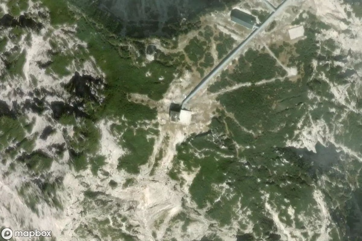
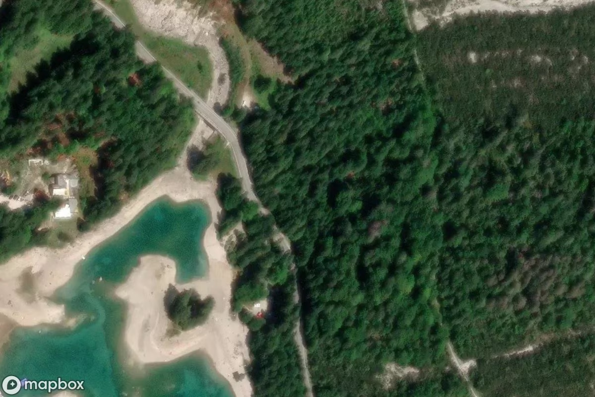
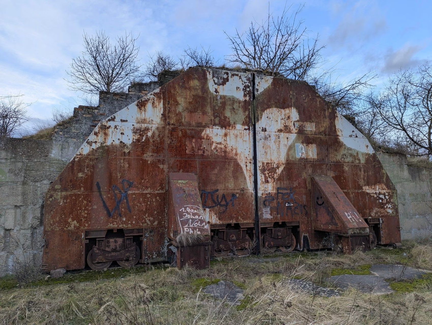
Radarstation
Pontebba / Ponteibe / Pontafel / Tablija · Italy
Radarstation is a Lost Place from the "Military Site" category in Pontebba / Ponteibe / Pontafel / Tablija, in the Friuli-Venezia Giulia region of Italy. One of 7 documented Lost Places of this category in Friuli-Venezia Giulia — and one of 39 across Italy. Added to the UrbexHunt community catalogue in February 2025.
You're seeing the public summary. Sign up free to see community photos, trip reports and exact coordinates from explorers who've already visited this place.
Sign up — it's freeQuick facts
- Category
- Military Site
- City
- Pontebba / Ponteibe / Pontafel / Tablija
- Region
- Friuli-Venezia Giulia
- Country
- Italy
- Added
- February 4, 2025
- Last updated
- March 29, 2026
- Military Site in Friuli-Venezia Giulia
- 7 documented
- Military Site in Italy
- 39 documented
- Total in Friuli-Venezia Giulia
- 104 lost places
Around Radarstation
13 other lost places within a 25 km radius, grouped by category:
Nearest lost places
 2 km
2 kmSeilbahn
Pontebba / Ponteibe / Pontafel / Tablija
 4 km
4 kmMussolini-Bunker
Bunker · Pontebba / Ponteibe / Pontafel / Tablija
 7 km
7 kmMilitärstützpunkt
Military Site · Pontebba / Ponteibe / Pontafel / Tablija
 9 km
9 kmBefestigte Linie der Ebenen
Military Site · Dogna / Dogne
 15 km
15 kmGasthaus
Chiusaforte / Scluse
 16 km
16 kmKinderheim
Hospital · Tarvisio / Tarvis / Trbiž
Continue exploring
More Military Sites in Italy
Browse every abandoned Military Sites from the UrbexHunt community across Italy.
All Lost Places in Friuli-Venezia Giulia
Discover the full Lost Places catalogue across this region.
All abandoned Military Sites
Every Military Sites in our database, from across Europe and beyond.
Save Radarstation and discover more in the UrbexHunt app
The free UrbexHunt mobile app lets you save favourites, mark visited places, upload photos, and discover new Lost Places nearby while you travel. Available for iOS and Android.
FAQ — Radarstation
What is Radarstation?
+
Where exactly is Radarstation?
+
Is urbex legal in Italy?
+
When was Radarstation added to UrbexHunt?
+
Is it safe to visit Radarstation?
+
What is Urban Exploration?
Urban Exploration — urbex for short — is the practice of discovering abandoned, forgotten, or hard-to-reach places. From decaying factories and silent hospitals to military bunkers and crumbling mansions, these are the structures where time seems to have stood still. What started as a niche subculture in the 1980s has grown into a worldwide community of photographers, historians, and curious explorers.
Every Lost Place tells a story. The peeling paint, the rusting machinery, the personal items left behind — they all carry traces of the people who once lived, worked, or played there. Urbex isn't about destruction or trespassing; it's about respectful documentation and preservation of architectural and social history that mainstream tourism overlooks.
Why explore Lost Places?
Lost Places offer something no museum can: an unfiltered, atmospheric encounter with history in its raw form. They're a playground for photographers chasing dramatic light, history buffs piecing together forgotten stories, and adventure seekers who appreciate the silence and stillness of forgotten places. Urbex also raises awareness about heritage preservation and the social changes that lead places to be abandoned in the first place.
Safety first — always
Abandoned buildings come with real risks. Before visiting any Lost Place, please follow these basic safety rules:
- Never explore alone. Always go with at least one companion.
- Wear sturdy footwear and a helmet — collapsing floors, broken glass and rusty metal are common.
- Tell someone where you're going and when to expect you back.
- Respect private property and local trespass laws. Never break locks or doors.
- Take only photos. Leave the place as you found it for the next explorer.
About UrbexHunt
UrbexHunt is a community-curated platform documenting 20,000+ Lost Places across Europe and beyond. Every location is submitted and verified by real urban explorers — never scraped from third-party sources. We provide verified locations, satellite imagery, and a free mobile app for iOS and Android so you can plan trips, save favourites, and connect with a respectful exploration community.